Cuomo: Prepare For Storm Featuring 6 to 12 Inches of Snow, Ice
Gov. Cuomo warns parts of the Hudson Valley could see 6 to 12 inches of snow mixed with sleet, ice and freezing rain.

On Sunday, Gov. Cuomo directed state agencies to prepare emergency response assets in advance of a major winter weather system forecast to impact much of the state with heavy snow, cold temperatures and ice in many areas. The storm system is expected to begin Monday morning and continue through Tuesday evening.
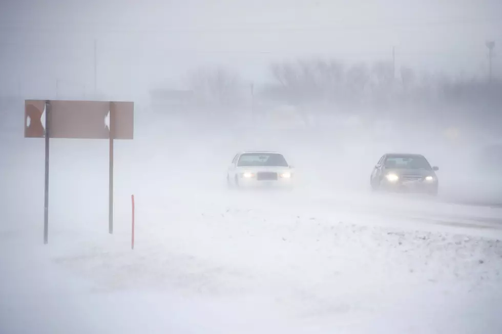
The National Weather Service warns a mix of dangerous winter weather could make travel "nearly impossible" in parts of the Hudson Valley.
Most locations across the state are forecast to receive snow accumulations from 6 to 12 inches, while some areas could be impacted by a mixture of sleet and ice up to 1/5 of an inch.
Travel conditions could be extremely difficult at times, especially late Monday evening through Tuesday morning, when heavier snow could combine with gusty winds and rapidly decreasing temperatures.
"Forecasts are calling for New York to experience another round of winter weather early this week and state agencies have already begun readying assets and personnel for a response," Governor Cuomo said. "Not only may some areas of the state see up to a foot of snow, but this storm is also expected to bring ice and a wintery mix to areas downstate, creating the potential for some very dangerous travel conditions. At it approaches, New Yorkers should take the time now to prepare their households for this storm and pay close attention to local weather forecasts."
For the northern areas of the Mid-Hudson, snow is forecast to hit in multiple rounds with most locations seeing either light snow or a mixture of sleet and snow during the day Monday with a switch to heavier snow late Monday evening into Tuesday morning, officials say.
Snow accumulations through Tuesday are expected to range from 3 to 6 inches with some locations topping 12 inches of snow. Downstate areas could see a mixture of sleet and/or ice, with accumulations up to a 1/10 of an inch, according to Cuomo's office.
For the lower Mid-Hudson, a wintry mix of freezing rain and/or sleet will begin Monday evening. North of the city, temperatures are expected to remain in the mid to upper 20s, which could result in up to 1/5 inches of ice across portions of the Lower Hudson Valley.
Weather forecasters are tracking another widespread precipitation event for Thursday and Friday that could bring even more snow, sleet, freezing rain and rain to the state.
The Department of Transportation is prepared to respond with more than 3,600 operators and supervisors, as well as the following assets:
- 1,612 large snowplows
- 313 large loaders
- 175 medium duty plows
- 80 chippers
- 73 wheeled and tracked excavators
- 52 tow plows
- 37 snow blowers
- 36 traffic tower platforms
- 18 graders
- 14 tree crew bucket trucks
- 11 pickup trucks with plows
Some of the most important tips for safe driving include:
- When winter storms strike, do not drive unless necessary.
- Use caution on bridges as ice can form quicker than on roads.
- If you must travel, make sure your car is stocked with survival gear like blankets, a shovel, flashlight and extra batteries, extra warm clothing, set of tire chains, battery booster cables, quick energy foods and brightly colored cloth to use as a distress flag.
- If you have a cell phone or other communications device such as a two-way radio available for your use, keep the battery charged and keep it with you whenever traveling.
- If you should become stranded, you will be able to call for help, advising rescuers of your location.
Keep Reading:
The 100 Best Places to Retire in America
KEEP READING: Here are the best places to retire in America
More From Hudson Valley Post


