

Nor’easter Threat Grows For New York, Including Hudson Valley
Forecasters say a wet and windy weekend is likely for the Hudson Valley and other parts of the state. Here's the latest from trusted sources.
The unsettled weather could potentially last into Monday.
Nor'easter Update: Rain, Wind, And A Messy Weekend Are Looking More Likely For The Hudson Valley

Confidence is growing that a coastal storm will develop off the East Coast late this week and bring a wet, windy weekend to the Hudson Valley. Two trusted local weather sources, Hudson Valley Weather and meteorologist Ben Noll, both weighed in Wednesday with updated assessments, and while the details are still coming into focus, the overall picture is becoming clearer.
For all the news that the Hudson Valley is sharing, make sure to follow Hudson Valley Post on Facebook, and download the Hudson Valley Post Mobile App
Ben Noll put it plainly: it's looking like a wet, windy weekend in the Hudson Valley, with unsettled weather potentially lasting through Monday.
For our area, he describes the storm as mostly an annoyance. The worst impacts will be felt along the coast from New York City and Long Island northward to Boston, where strong onshore winds could push water inland and produce moderate coastal flooding.
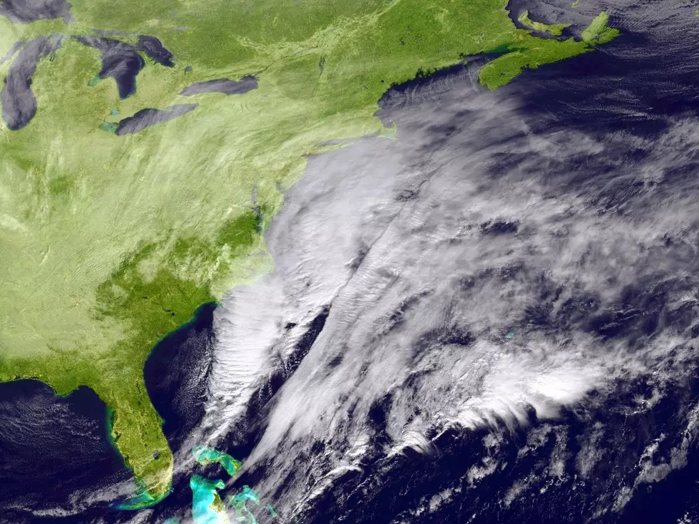
Hudson Valley Weather took a deeper dive into the setup. They say the bigger story isn't the storm's strength alone; it's how slowly it's expected to move.
Once the coastal low develops, it could slow dramatically, stall, or even meander back toward the coast before finally moving away. That kind of unusual motion turns what might otherwise be a routine coastal storm into a multi-day impact event, and the cumulative effect of prolonged northeast winds and repeated high tide cycles is what has forecasters paying close attention.
For the Hudson Valley, Hudson Valley Weather says conditions should remain mostly quiet through Thursday. Rain chances begin increasing Friday night and into Saturday, spreading from east to west.
The area east of the Hudson River currently carries the higher probability for meaningful rainfall, with more uncertainty as you head west into the Catskills.

Saturday is currently the day with the greatest potential for impacts, with both the European and American models keeping the first half of Saturday relatively dry before conditions deteriorate.
On the wind side, even if the storm's center stays well offshore, the pressure gradient between strong high pressure to the north and the coastal low to the southeast could produce extended periods of gusty northeast winds Friday into the weekend.
Current guidance shows chances of wind gusts exceeding 35 mph across parts of the eastern Catskills, Mid-Hudson Valley, Taconics, and Berkshires.
Trees still have their leaves, so isolated power outages can't be ruled out.
The storm is now looking likely. The specific impacts for the Hudson Valley are not yet locked in and will depend heavily on the final track. Hudson Valley Post will continue updating this forecast through the week.
The 50 Most Expensive Weather Disasters in Recent Decades
LOOK: The most expensive weather and climate disasters in recent decades
Gallery Credit: KATELYN LEBOFF
The Most Extreme Temperatures in the History of Every State
LOOK: The most extreme temperatures in the history of every state
Gallery Credit: Anuradha Varanasi
25 costliest hurricanes of all time
More From Hudson Valley Post


