Early-Season Nor’easter Threat Grows For New York, Hudson Valley
Heads up, Hudson Valley. Meteorologists are tracking a potential early-season nor'easter that could affect our region.
The biggest questions right now are how close the storm tracks to the coast and how strong it gets, and the models are still disagreeing on both.
A Potential Early-Season Nor'easter Is Being Watched For This Weekend

Meteorologists are keeping a close eye on a storm system that has the potential to develop into an early-season nor'easter this weekend, and while nothing is locked in yet, the signal has been consistent enough that Hudson Valley residents should know about it heading into the week.
For all the news that the Hudson Valley is sharing, make sure to follow Hudson Valley Post on Facebook, and download the Hudson Valley Post Mobile App
The system could bring heavy rain, gusty winds, and coastal flooding to the New York area and the broader Northeast late this week into the weekend of September 26th and 27th.
The timing of the worst conditions appears to be shifting toward later Sunday into Monday morning.
Here's where things stand right now.
Forecasters are tracking a coastal low-pressure system that is expected to develop off the East Coast, but the two main computer models used in forecasting are telling different stories.
The American GFS model brings the low closer to shore, which would mean higher winds, heavier rain, and more significant coastal impacts for the New York area.
The European model keeps the low further offshore and stronger, which would limit inland impacts but still produce a prolonged stretch of unsettled weather along the coast.
A relatively small difference in the storm's track could be the difference between a soggy but manageable weekend and something significantly more impactful.
Hudson Valley Weather Is Watching
Local forecasters at Hudson Valley Weather have been watching this signal for over a week and say the trend has been notable enough to pay attention to.
They laid out three possible scenarios for the Hudson Valley and Catskills, ranging from the storm staying well offshore and leaving the region mostly dry, to the low tracking far enough west to produce periods of heavy rain and gusty northeast winds across the entire region.
Heavy Rain, Gusty Winds, Flooding Possible
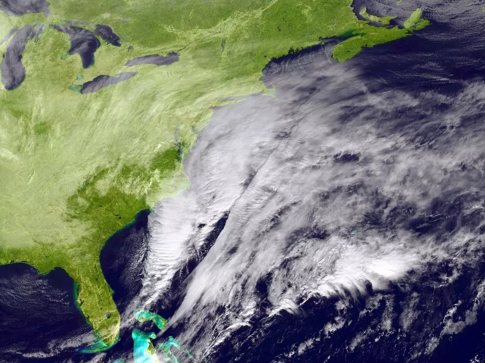
This weekend's full moon means tidal levels will already be elevated, and a stronger or closer storm track could trigger significant coastal flooding, dangerous surf with waves reaching 15 to 18 feet offshore, and serious beach erosion throughout the Northeast
Wind gusts in coastal areas could reach 40 to 60 mph if the more aggressive track plays out. Temperatures will drop noticeably regardless of the storm's intensity, with highs expected to sit 10 to 15 degrees below average, keeping much of the region in the 50s and low 60s through the weekend.

For Hudson Valley residents with outdoor plans this weekend, it's worth keeping a close eye on the forecast as it becomes clearer over the next few days. The forecast confidence will improve significantly by midweek.
Hudson Valley Post will continue monitoring this storm and update readers as the forecast firms up.
The Dates When New York State Typically Sees Its 1st Snowstorm
These New York Counties Deal With More Snow Than Most Of America
More From Hudson Valley Post