Racist Map of Poughkeepsie Warned of ‘Negroes’ In Neighborhoods
A map of Poughkeepsie from the 1930s shows just how badly Black citizens in the Hudson Valley were discriminated against.
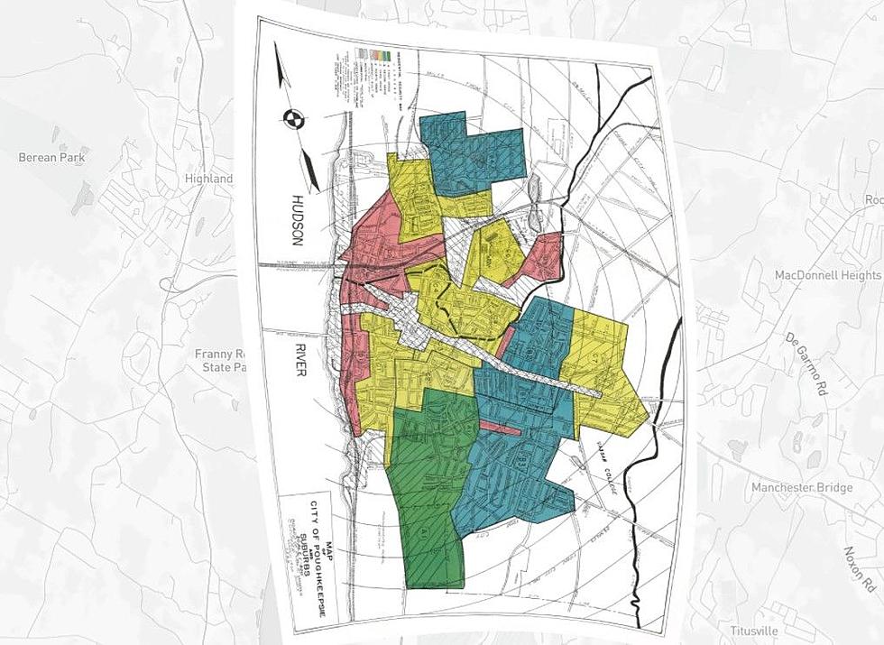
The map shows how some streets and neighborhoods in the City of Poughkeepsie were stigmatized because Black families lived there. A practice called "redlining" was used by mortgage lenders to determine the eligibility of home loans. If a house was located in an area that was deemed "undesirable," lenders would consider it a higher risk, making it almost impossible to receive a loan. Some areas in the City of Poughkeepsie were downgraded simply because residents were Black.
We researched an interactive version of the map that has been archived by the University of Richmond. In it, we discovered some shocking descriptions of neighborhoods in the City of Poughkeepsie that have undoubtedly led to their financial decline over the following decades. Neighborhoods in the city that are poorer and more rundown today can trace the root cause of its plight back to this unfair map.
Scroll below to read the disturbing descriptions of Poughkeespsie's neighborhoods and streets from the 1937 redlining map.
Mapping Poughkeepsie's Racist Past
Gallery Credit: Boris
6 Real Hudson Valley Locations Featured in 'Hamilton'
This Hudson Valley Home is Hiding Another House in the Attic
Gallery Credit: Boris
More From Hudson Valley Post